Our Solutions
We provide end-to-end geospatial services that turn complex data into actionable intelligence for governance and development.
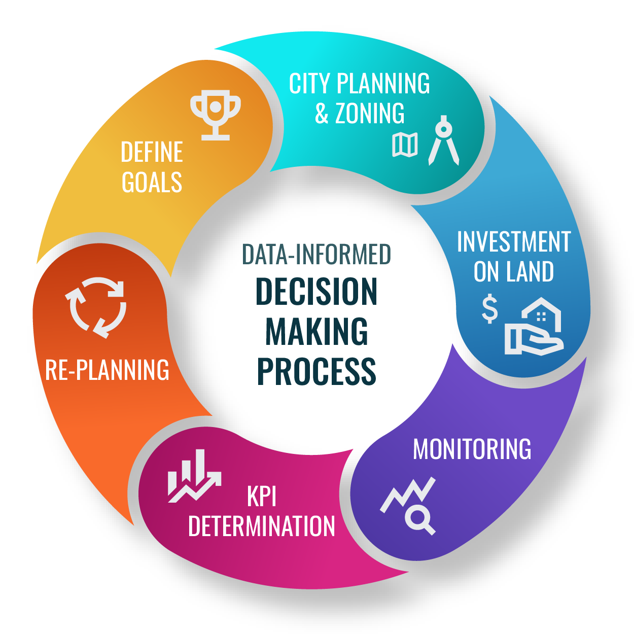
Data-Informed Decision Making Process
Our core philosophy revolves around a cyclical, data-driven process. We help organizations define goals, plan and zone effectively, monitor investments, determine KPIs, and continuously re-plan for optimal land governance and urban development.
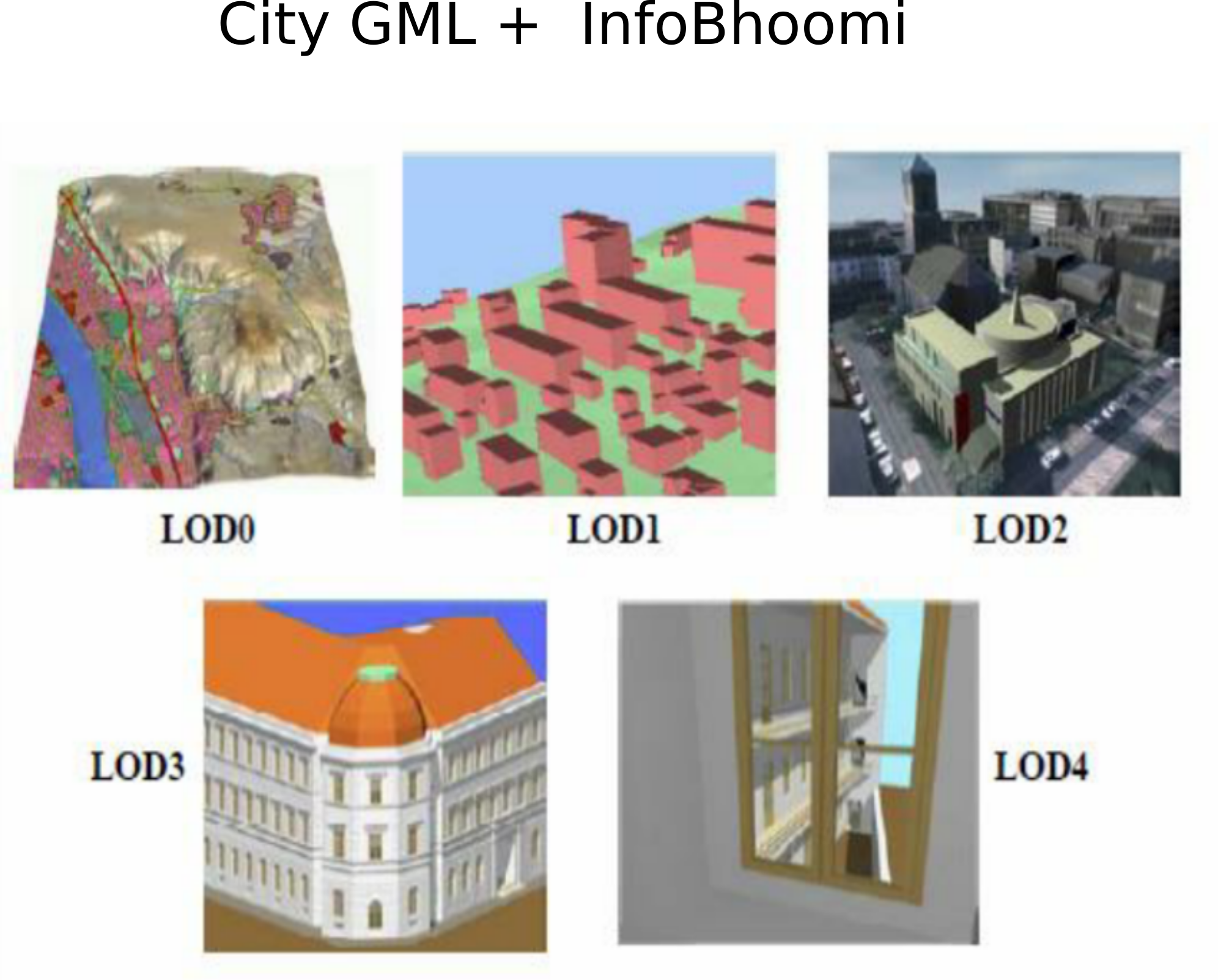
3D City Modeling (LOD0-LOD4)
We create comprehensive 3D models of urban environments at various Levels of Detail (LOD). From basic block models for macro analysis to detailed architectural models, our visualizations are essential for modern urban planning and simulation.
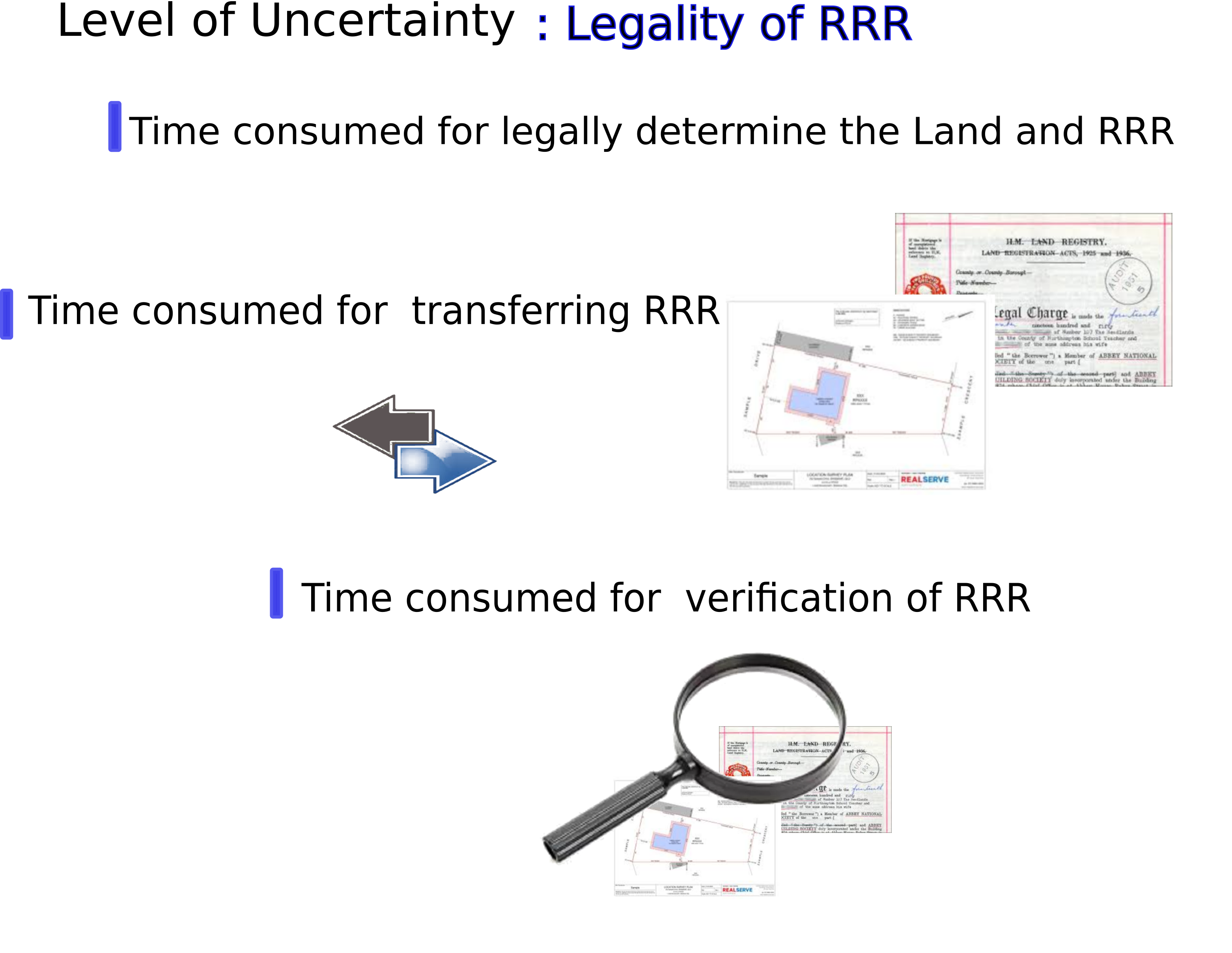
Land Administration & RRR
We specialize in establishing the legality of Rights, Restrictions, and Responsibilities (RRR) for land parcels. By digitizing deeds and integrating survey plans, we create secure, transparent, and efficient land registration systems that build trust and encourage investment.
GIB-R1 GNSS Receiver
Engineered in Sri Lanka, the GIB-R1 is a high-precision, low-cost GNSS receiver designed to meet the rigorous demands of local surveying, construction, and agricultural sectors.
Key Features
- Centimeter-level accuracy with RTK
- Multi-constellation support (GPS, GLONASS, Galileo)
- Rugged, all-weather design (IP67 rated)
- Long-life battery for all-day fieldwork
- Seamless integration with local survey software
- Affordably priced for the Sri Lankan market