What We Do
End-to-End Geospatial Intelligence.
Three connected practices - decision support, 3D city modeling, and land administration - built on a unified spatial data fabric.
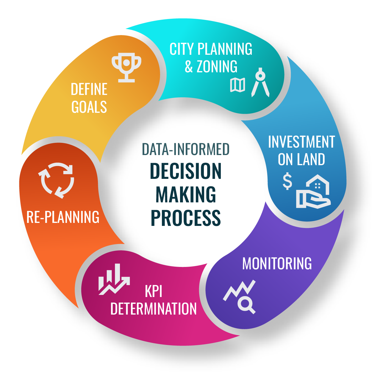
Practice 01 · Decision Support
Data-Informed Decision Making
We close the loop between strategy and operations: a measurable goal, a spatial plan, instrumented monitoring, and a re-planning cycle that institutions can actually run.
- Define goals against measurable spatial KPIs.
- Plan interventions on a unified base map.
- Monitor execution in near real-time dashboards.
- Re-plan on the same data - no exports, no breakage.
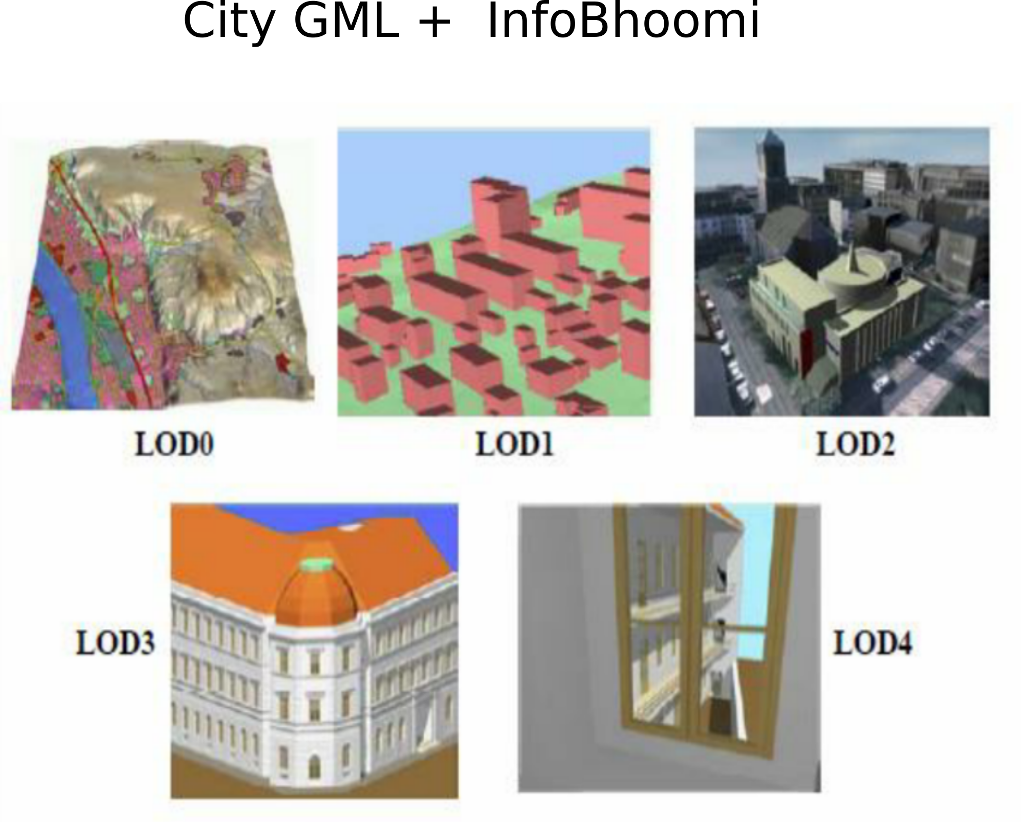
Practice 02 · 3D Modeling
3D City Modeling, LOD0 to LOD4
From building footprints to interior-grade detail - a full Level-of-Detail stack that supports planning approvals, infrastructure simulation, and immersive stakeholder review.
- LOD0 footprints and LOD1 prismatic blocks for city-scale analytics.
- LOD2 roof structures for solar, drainage, and zoning studies.
- LOD3 façades for visual-impact and heritage review.
- LOD4 interiors for asset and facilities management.
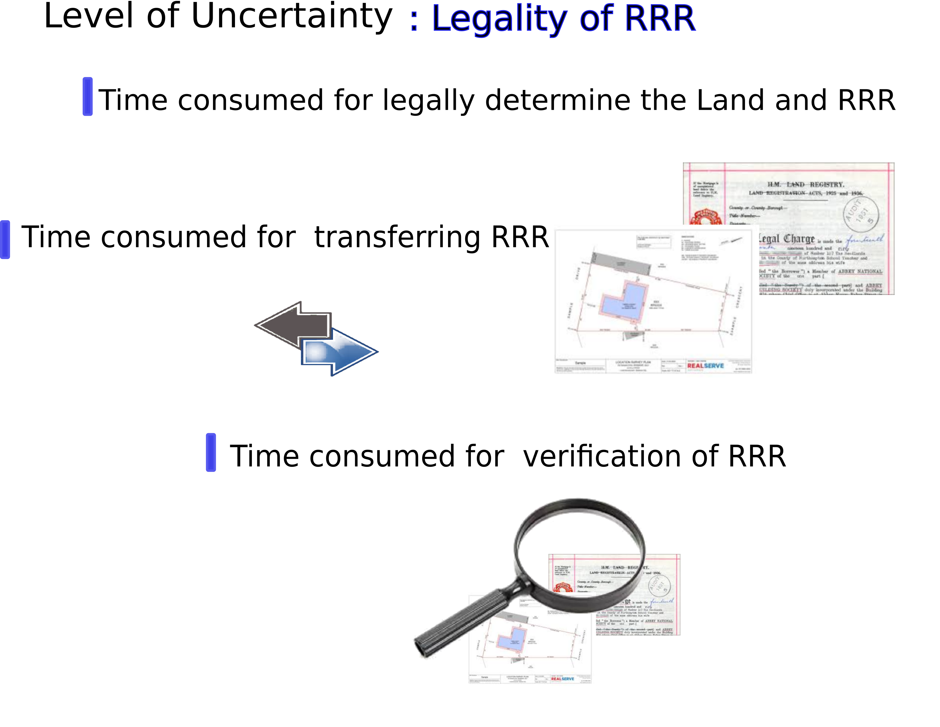
Practice 03 · Land Administration
Land Administration & RRR
We codify Rights, Restrictions, and Responsibilities into digital workflows - linking historical deeds to modern parcels and giving every authority a single source of truth.
- Deed digitization with structured metadata extraction.
- Spatial reconciliation of deeds to surveyed parcels.
- RRR encoding aligned to LADM (ISO 19152).
- Auditable change history for every record.